New ABOR Grant Will Use CyVerse's Technology and Expertise to Mitigate Wildfire Risk
Through a recent $900,000 multi-organization grant from ABOR, CyVerse will work with Arizona researchers to develop a new 3D wildfire fuel mapping and modeling framework to assist with wildfire risk mitigation.
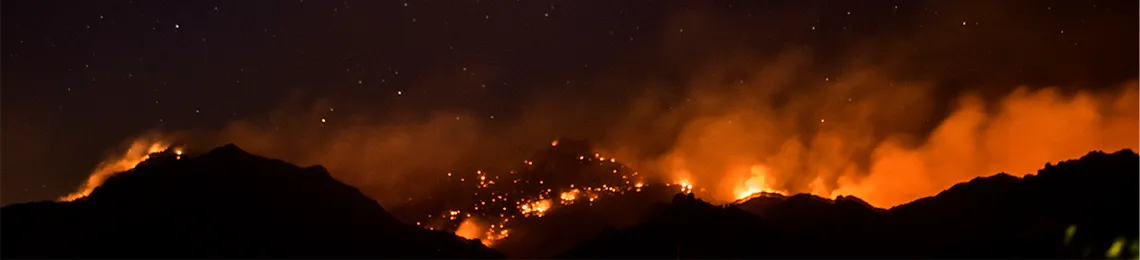
Bighorn Fire (Credit: UArizona Health Sciences/Kris Hanning)
Increases in wildfire in the wildland-urban interface (WUI), including fires in grass-, shrub-, and tree-dominated ecosystems, are creating greater demand on rural fire departments and land managers across Arizona. Yet, the data and models used by local, state, and federal land managers to create and communicate strategic fire and fuel management strategies provide poor accuracy at the spatial scale required for effective fuel treatment planning. The use of advanced three-dimensional (3D) fuel assessments and fire behavior modeling can guide agencies and local officials with planning and implementing hazardous fuel reduction and wildlife mitigation programs that meet community needs while improving ecosystem health and resilience.
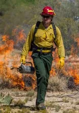
Tyson Swetnam at a prescribed fire (Credit: Joe Parker)
Through a recent multi-organization grant from the Arizona Board of Regents (ABOR), CyVerse will work with Arizona researchers to develop and apply a new 3D wildfire fuel mapping and modeling framework for fuel reduction, wildfire mitigation, and ecosystem restoration. The $900,000 three-year project is led by Andrea Thode and Andrew Sánchez Meador of Northern Arizona University (NAU). Along with NAU's Ecological Restoration Institute (ERI), School of Forestry (SoF) and Southwest Fire Science Consortium (SWFSC), and the US Geological Survey's (USGS) Southwest Biological Center (SBSC) and Land Change Science Program, University of Arizona (UA) participants will include CyVerse as well as the UA Department of Geosciences and Arizona Geological Survey (AZGS).
The project will assess current fuel and model fire behavior and post-fire flooding in the WUI to assist with determining the ladder fuels, or fuel that can carry a fire burning in low-growing vegetation to higher vegetation, that need to be removed. An ultimate goal of the project is to assist Arizona communities by providing information that will inform their ability to leverage federal partnerships and funding for fuel reduction and flooding mitigation work for future wildfires. CyVerse's collaborators at USGS are uniquely positioned to bridge the gap between science and land management, and CyVerse is ideally suited to provide land managers and fire-affected communities access to fuel and wildfire risk information through advanced computing power, trainings, and data visualization that can be used to develop solutions to climate change and wildfire crisis.
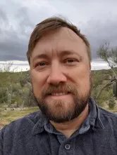
Tyson L. Swetnam
Tyson Lee Swetnam is CyVerse's Co-Principal Investigator on the project. Swetnam, an Assistant Professor of Geoinformatics in the School of Natural Resources and the Environment and the BIO5 Institute at the University of Arizona, has over 15 years of experience working with the same types of big datasets derived from remote sensing that will be used to measure forest structural changes and wildfire risk over time across the fire-prone forests throughout the state of Arizona.
"I am excited to work with my colleagues in the UA Geosciences, NAU Ecological Restoration Institute, the AZGS, and the USGS on this next generation of forest fire risk maps in my home state of Arizona," Swetnam said. "In the six years I've worked with CyVerse, we have worked hard to develop the cyberinfrastructure that will support the project."