Drone Summit Convenes UAS and sUAS Researchers at Biosphere2
Research leaders meet to discuss the future of drone data management
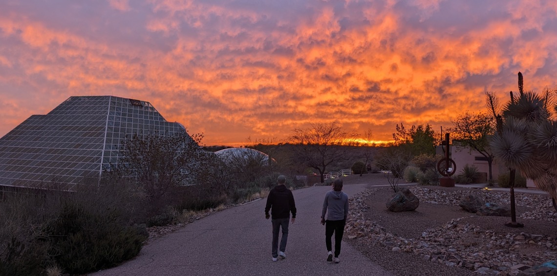
Photo: T. Swetnam
Drones, also known as Unmanned Aircraft Systems (UAS), are valued for their low operating costs, flight capabilities, and ability to collect scientific observations. Drone data are increasingly popular across industries and academic research on public lands and for precision agriculture. The birds'-eye-view provided by drones has led to new insights and opportunities across agriculture, civil engineering, natural resource management, and for disaster response.
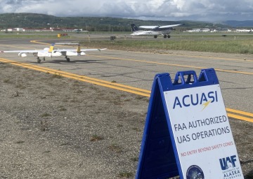
ACUASI SeaHunter preparing to taxi with other aviation (Cessna-sized), and Alaska Airlines in the background.
Photo: Catherine Cahill, ACUASI
"Over the last eight to ten years, thousands of researchers have purchased their first drones and become licensed small UAS pilots (sUAS), but their workflows for collecting, analyzing, and sharing drone data have largely been ad hoc endeavors that have lacked a community standard or a national data repository for publishing their drone data," said Dr. Tyson Swetnam, PI of a TRIF-supported 18th Mile Award from the UArizona Office for Research, Innovation, and Impact. The grant program serves as seed funding for research aligned with the UArizona's goals for meeting challenges of the '4th Industrial Revolution', with this grant awarded specifically to develop proposals to build a national cyberinfrasctructure center of excellence focused on drone data and scientific applications.
"Without a prioritized effort to identify, make searchable, and provide long-term data curation, UAS and sUAS data are increasingly at risk of becoming 'dark data' which are lost or unusable," Swetnam added.
In January, Swetnam and Gillan traveled to the University of Alaska Fairbanks (UAF), where they met with colleagues at the Alaska Center for UAS Integration (ACUASI). UAF's ACUASI is the only organization in the US which is at once a Federal Aviation Administration (FAA) UAS test site, a member institution in FAA Center of Excellence, and a FAA BEYOND test site, focused on beyond-line-of-visual-sight flights. ACUASI also hosts the Global Autonomous Systems Conference (https://autonomousalaska.com/) in Anchorage, which is focused on building collaboration amongst practitioners, researchers, and policy makers about the current state and future of autonomous systems and artificial intelligence in Alaska, across the Nation, and around the world.
Swetnam and Gillan organized a "Drone Summit" at the Biosphere2 in Oracle, AZ on March 27-28, 2024 to discuss and identify possible collaborative solutions to address some of the challenges associated with operating and curating scientific drone data.
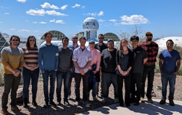
Researchers from UArizona (CyVerse), University of Alaska Fairbanks, Purdue University, National Ecological Observatory Network (NEON, Battelle Inc.), San Diego Supercomputing Center, Open Topography, and experts from Improving Aviation LLC, and Google Earth Engine Community, who specialize in geospatial science and computing, discussed every aspect of the drone data lifecycle to find common problems to tackle together. Outputs of the Drone Summit include setting up a Memorandum of Understanding (MOU) between UArizona and University of Alaska Fairbanks focused on drone data management and data science applications, and new proposals focused on cloud computing solutions, metadata standards, and infrastructural platforms for sharing drone data. Swetnam, Gillan and several of the Summit participants have identified a couple of federal program solicitations that they can respond to with the information and network of collaborators that the Drone Summit enabled.
UAF's Peter Webley noted that "the number of researchers with access to drones/UAS has grown dramatically and will continue to expand. There will be a great benefit from being able, as a community, to access datasets and observations from these innovative platforms to advance research questions and understand the changing environment. With drone/UAS operators and data scientists working together, we can transition the data/observations collected from drone/UAS missions into the wider community and support expanded research collaborations and the broader impacts of the collected data."
Samapriya Roy, a Community Advocate for Google Earth Engine, said upon leaving Biosphere2, "the Drone Summit was a wonderful exercise in bringing together key actors who are focused all the way from collecting drone day to building applications on top and then processing and disseminating them. Very few summits have a focus on stakeholders in the science pipeline and this made this Summit really engaging and unique."